Showing posts with label GIS. Show all posts

Monday, April 23, 2012

Beautiful maps with R and Google Maps

It’s been awhile since I have posted on this blog. I have been caught up in the midst of publishing my thesis works as a book which is now available for at amazon and trying to be adventurous during the harsh but still exciting Norwegian winter.
A friend of mine asked me last week to help him plot locations of boreholes, that he is doing research on, to a decent map. I came up with a suggestion of creating it in R using Google Maps as a base map. Of course this could have been done easily and more aesthetically attractive using the conventional GIS softwares. It is more exciting and reproducible where the R script can be reused easily.


The location of the boreholes was originally recorded using gps in UTM coordinate format. Therefore, I used the spTransform method of rgdal package to convert them into latitudes and longitudes.  The rest of the codes are listed below.


Saturday, January 28, 2012

Maps give Europeans close-up picture of emissions from industrial facilities

Online maps published by the  European Pollutant Release and Transfer Register (E-PRTR), allow users to pinpoint the key environmental data and the main sources of air pollution from industrial facilities across Europe. The European Pollutant Release and Transfer Register (E-PRTR) is the a Europe-wide register that provides easily accessible key environmental data from industrial facilities in European Union Member States and in Iceland, Liechtenstein, Norway, Serbia and Switzerland. It replaces and improves upon the previous European Pollutant Emission Register (EPER). The register contains data reported annually by some 28,000 industrial facilities covering 65 economic activities across Europe. The interactive map shows where certain pollutants are released from individual industrial plants. . The Europe-wide register aims to help Europeans actively engage in decisions affecting the environment. The map search option provides a geographical approach to the E-PRTR data. The map can even be viewed here in maximized version.

Friday, January 13, 2012

5 Great Maps... That are just great!

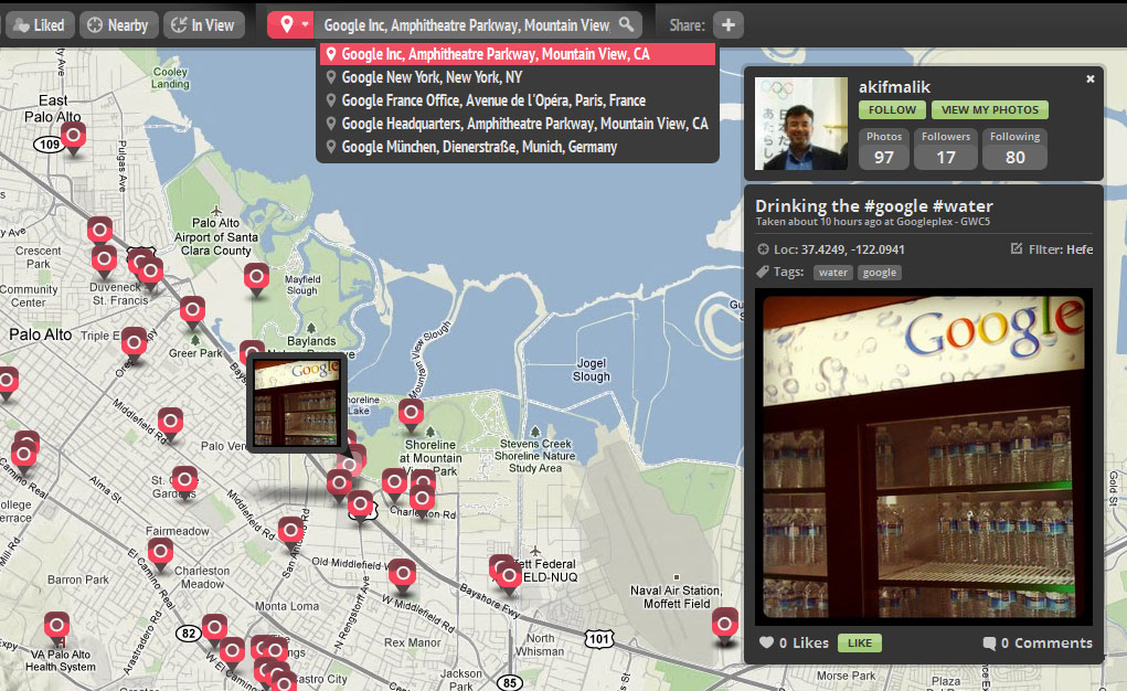
Google's Geo Developer blog posted about five great maps developed based on the Google's Maps API. The list includes the renowned photo sharing tool - instagram's app called InstaEarth,  which makes use of the Places API to help users discover instagram photography in a map.

InstaEarth

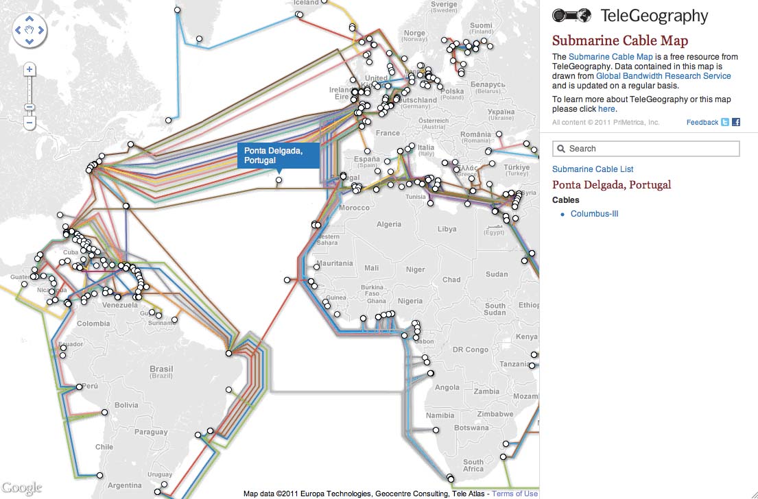
Another interesting application that uses the Maps API is the Submarine Cable Map from TeleGeography which makes use of the Google Fusion Tables to generate map layers of submarine cable routes. The map also uses Styled Maps to customize the standard Google base maps for better visualization of the cable routes.

TeleGeography - Submarine Cable Map

Check out the rest three here.